
The City of Omaha Planning Department Housing and Community Development (HCD) Division uses a FileMaker app as a key technology tool for managing city housing and community development projects. The app is extensive.  It was built in-house over many years and is highly customized to departmental needs. It tracks project applications, funding, contacts, vouchers, programs and more.
There were three things, however, their FileMaker app couldn’t do:
- The app didn’t allow a project to be defined spatially. In other words every project had to be tied to a single address which just isn’t always realistic. For example there are projects that involve splitting parcels into multiple new parcels each with their own new address, new developments that don’t even have an address yet, or boulevard projects that are better represented by a line or polygon instead of a point.
- Maps in the app were non-existent or limited to what could be displayed using a URL.
- The app didn’t take advantage of the wealth of GIS Data already being produced and managed by other departments within the city and county government.
Before LuminFire got involved, the only way HCD staff members could map project sites is to export a list of addresses, email a request to the GIS department, and wait for them to produce a static map. Not only is this process terribly inefficient but it is susceptible to data entry variations causing mismatching errors and other inaccuracies. As it turned out the Douglas County GIS Department already had a wealth of Esri ArcGIS web services hosted and ready for departments like HCD to use at no additional cost. The only thing HCD needed was the expertise on how to connect FileMaker to these web services. This is where LuminFire was able to help.
LuminFire’s primary goal for the project was to improve the existing FileMaker data model, entry process and management of projects by allowing them to be defined spatially instead of by just a single address. Secondary goals included creating spatially driven reporting, improved interoperability, reference mapping, and modernizing user interfaces throughout the solution. The following screenshots and captions illustrate how we accomplished these goals and provide insight into just how powerful integration with GIS can be:
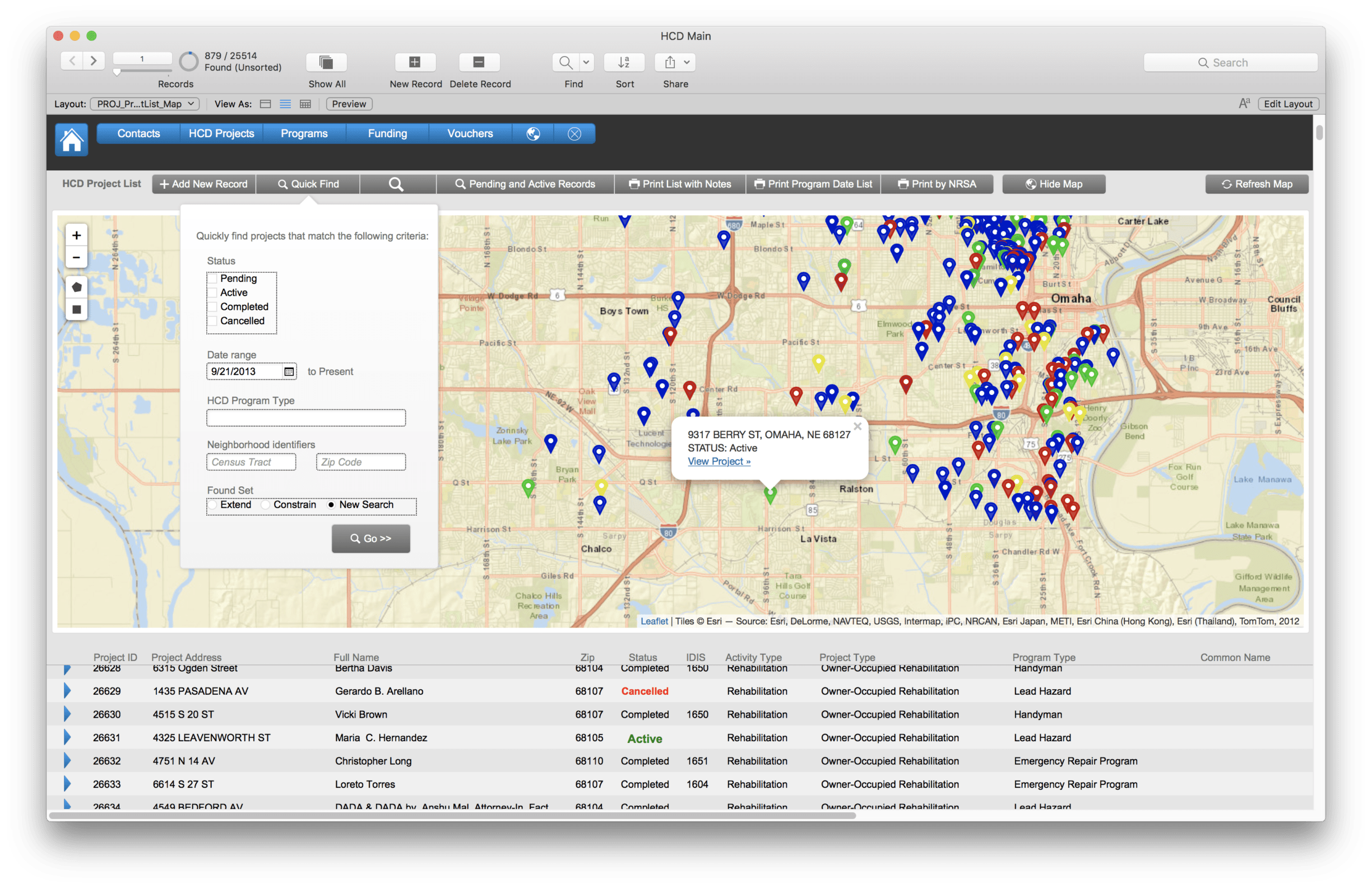
The primary HCD Project’s list view now has an interactive map that updates on-the-fly as the found set changes. Pins represent projects and they are color coded according to status. You can click on any pin to see project details and link that takes you to that projects FileMaker record. Spatial searching is also possible–drawing a rectangle area of interest on the map will perform a find in FileMaker for all the projects that fall within it.
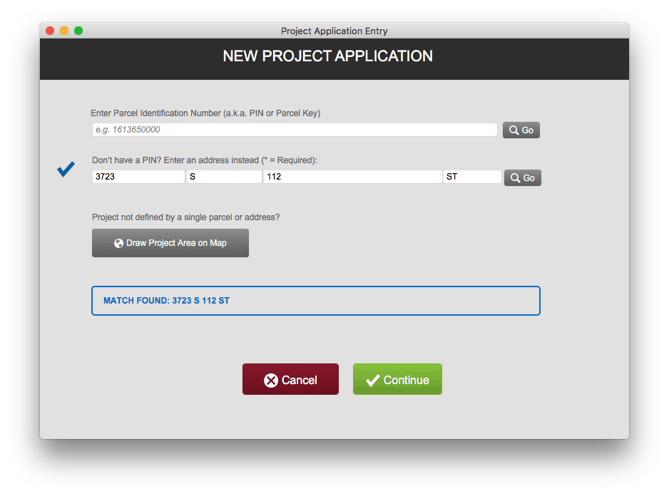
The newly redesign project application entry process provides three options for spatially defining a project and matching it to existing GIS data:
- PIN – If the application contains a parcel identification number (PIN) it used to query GIS Parcel service and automatically return all information known about the parcel as well as the feature geometry
- Address – House number, street, and cardinal direction are used to query the county’s geocoding service which returns location as well as parcel information and other attributes
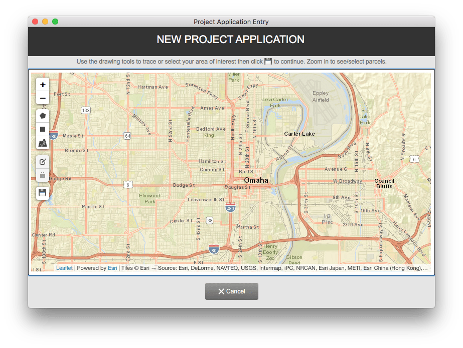
- Map – If there is no PIN or address available or the project simple is more complex/extensive than a single parcel or address users can find the location on a map and draw the project area of interest using point, line, and/or polygon drawing tools.
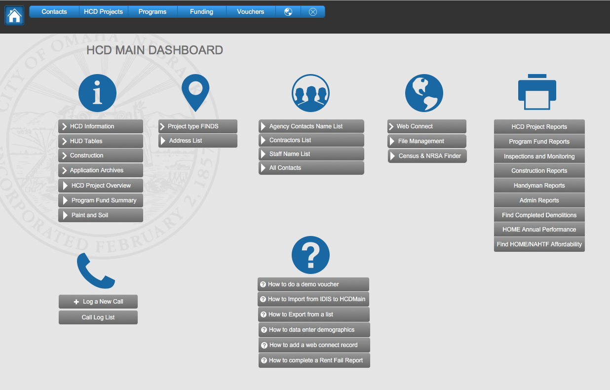
LuminFire improved numerous other interfaces and helped HCD staff learn to use new themes and layout tools so they could convert old layouts and design new layouts according to modern standards moving forward. For example, their old dashboard…
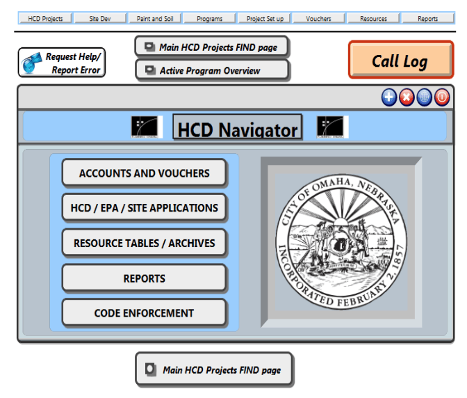
was updated to a consistent and better designed starting point…
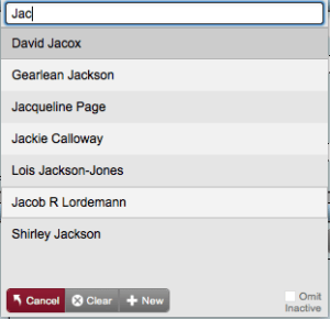
Another example that we’re particularly fond of is this card window based contact linker module. It does type ahead contact searching/filtering and allows creation of new contacts anywhere that relationships to people or organizations are tracked (e.g. project coordinator, contractor, property owner, etc.)
“Thanks to LuminFire for helping us improve our application with custom maps! Working together was easy and collaborative. The fmIgnite theme inspired better design throughout the solution.” – Dave Tollefsrud, City Planner
LuminFire GIS solutions help businesses derive value from data through maps, custom applications and spatial analyses. We have developers on staff that are trained in GIS and have the expertise to make your projects a reality. They regularly speak at regional and national GIS conferences as well as contribute to the GIS open source community. FileMaker and WordPress are among the tools we use to integrate GIS solutions.
If your business has a FileMaker app or website that needs to be taken to the next level, we can make that happen. Our expert engineers can build exactly what you need. We build brilliant custom solutions that make your business more effective, productive, and profitable. Contact us to talk about your future solution.


Tim Cimbura – CEO and Software Engineer
Tim is an expert in creating custom business solutions that make businesses more effective, productive, and profitable. He specializes in rapid application development with the Claris platform including FileMaker and WordPress. He also knows Apple macOS technology inside and out.