
![]()
CityTech Solutions, Inc. provides software to city and county governments all over the United States. As one of leading Software as a Service (SaaS) providers for local governments, CityTech provides apps to city Departments such as, Building and Safety, Planning, Code Enforcement, Public Works, Environmental and Fire Prevention. Public agencies look to CityTech to provide them with efficient and cost effective software that enhances and improves the customer service that they provide to their constituents.
Using the powerful custom software platform of Claris FileMaker, CityTech provides Building Permits, Code Enforcement, Case Management and Stormwater management systems. CityTech’s core functionality depends heavily on location-based data such as GPS coordinates, parcel boundaries, city zoning areas, and aerial imagery. Availability of location-based data, also known as spatial data or GIS (Geographic Information System) data, has grown rapidly in recent history, and CityTech recognized the need to be able to store spatial data, integrate with existing GIS service providers, and ultimately provide maps and map-based interfaces for their users. GIS integration also helps reduce the need for data entry and the human error that comes along with it.
Esri is a market leader in GIS software, and their ArcGIS platform was available to or already being used by many CityTech customers. CityTech knew that connecting with ArcGIS to add GIS and mapping capabilities to their existing platform was essential to remain competitive. For customers without their own GIS and spatial data, CityTech purchases data and uses ArcGIS Online, a low- cost cloud-based GIS hosting service by Esri. LuminFire’s expertise in FileMaker integrations and GIS made integration with Esri GIS systems possible regardless of who was using it or where it is hosted.
CityTech Solutions engaged LuminFire because of our expertise in Claris FileMaker and GIS integrations. LuminFire’s approach to GIS integration begins with BrilliantConnect, a FileMaker add-on containing pre-built connectors that simplify common but difficult and advanced programming tasks. These connectors allow Claris FileMaker to talk to powerful external web services, such as ArcGIS, and to perform new tasks such as rendering an interactive map in a web viewer. BrilliantConnect is built with all native FileMaker scripting and does not require any plug-ins, so it will run effectively on Claris/FileMaker Pro, Go, and WebDirect. BrilliantConnect saves time and money in implementing advanced features, allows integration work in custom solutions to be completed very quickly, and makes maintenance updates as seamless and painless as possible.
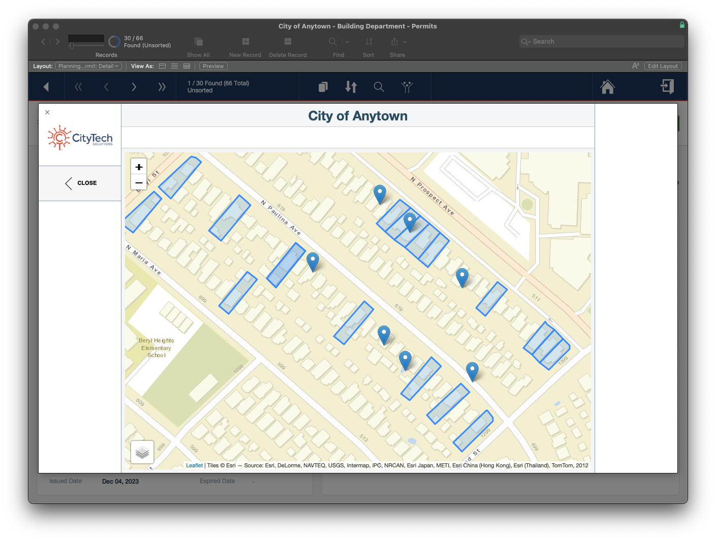
The first feature we built uses LuminFire’s BrilliantConnect Maps module to provide a parcel map interface for creating a new permit or code violation record. Parcel data can be stored in a private ArcGIS Server, ArcGIS Online, Amazon S3, or even as GeoJSON text in FileMaker itself. Users can search for and select one or more parcels to begin the new record workflow.
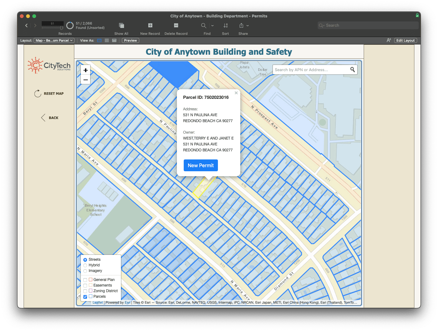
If aerial imagery is available it can be used, along with any other desired basemaps, to help users identify the correct parcels/locations.
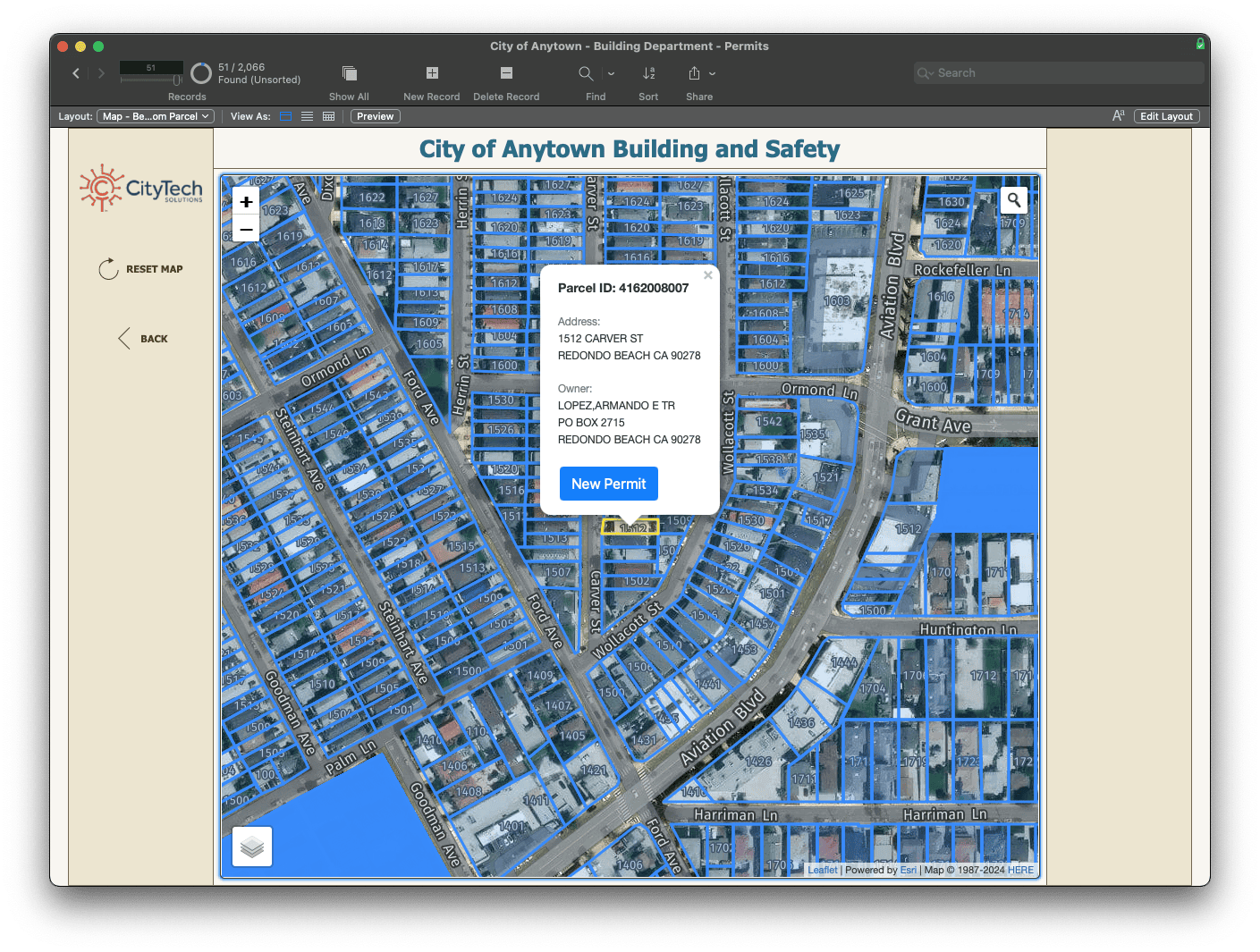
Additional layers, if they exist, can also be made accessible, such as the General Plan, Easement, and Zoning District layers pictured here.
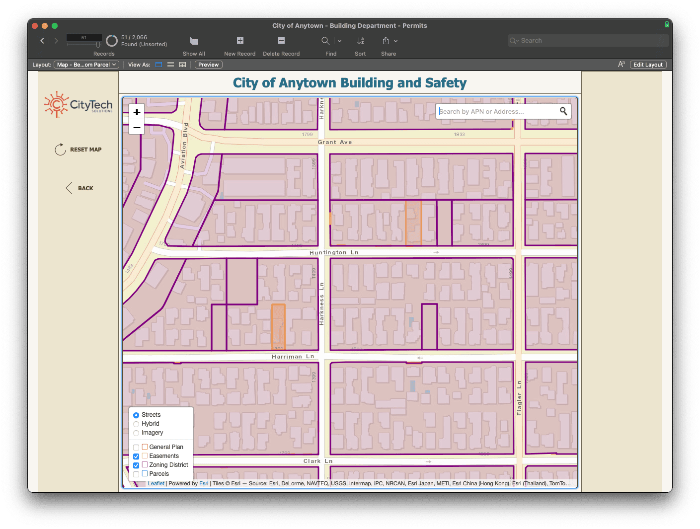
Customizable search widgets can be added that restrict results to specific datasets, specific geographic areas, or even specific attributes such as a list of parcel ID numbers. Clicking on a search result will pan/zoom the map to that location and allow the new record process to proceed.

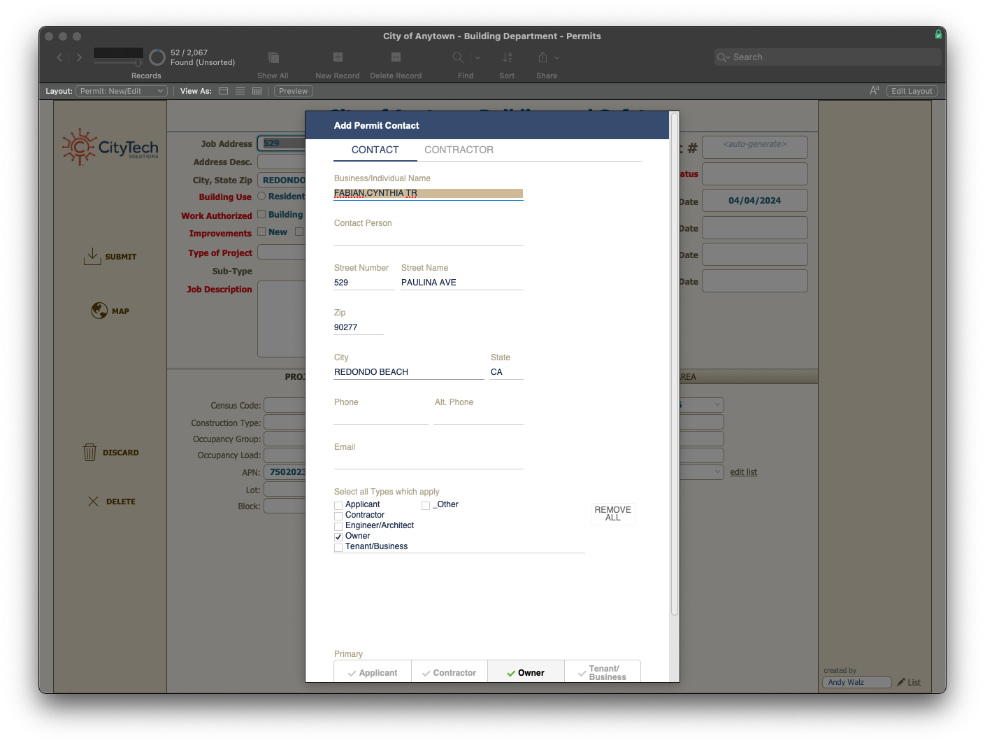
When adding a new record, data from the GIS service is used to prefill forms in FileMaker. For example, it is common practice for county tax assessors to track detailed information on parcels and their owners. This data can usually be purchased or found freely available online through GIS services. BrilliantConnect makes it easy to use this data in FileMaker without any manual data entry. Pictured below is contact information pulled from a GIS service into CityTech’s new permit entry process.
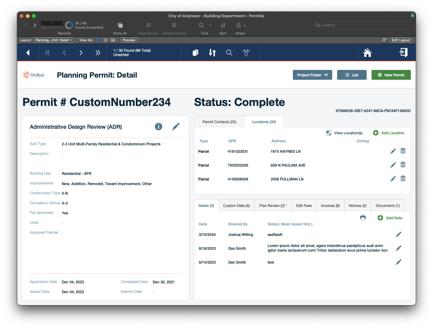
Once GIS data is accessible in FileMaker the possibilities for using and storing it are endless. CityTech allows multiple locations, represented as either points or parcels, to be associated with a permit and maps can be viewed at any time, optionally with other raster layers enabled.
BrilliantConnect also allows data to be written to external applications, like ArcGIS Online via GeoJSON in order to share spatial data created by FileMaker users with ArcGIS users or other systems, apps, and websites that integrate with ArcGIS.
Interactive maps give users a visual representation of data they’re working with in a way that simply isn’t possible with just text. Maps will help users find, identify, and better understand the parcels and areas of interest they are working with. Pre-filling forms using existing data helps prevent human error, reduce duplicative data entry, and increase the interoperability of data in FileMaker with other systems and agencies. These advantages help give the CityTech Permits solution a leg up over competitors’ solutions. Additionally, GIS functionality allows CityTech to charge clients a higher price to account for the added value, and can help their clients save money by consolidating their services to one provider.
CityTech staff have said their users really love the new mapping interfaces. Overall, LuminFire’s solution enabled CityTech to meet the needs of their users and sell their product to a wider audience making them more profitable.
“BrilliantConnect has allowed CityTech to leverage the power of ESRI in our CityTech permitting systems. Whether our apps display data from a City’s in-house ArcGIS system or our ArcGIS Online system, BrilliantConnect seamlessly provides that connection that brings spatial data to life inside our software.” – Mark Abbott, Director
Would your business profit from a custom solution that integrates mapping and GIS with FileMaker or your website? LuminFire can help.

Tim Cimbura – CEO and Software Engineer
Tim is an expert in creating custom business solutions that make businesses more effective, productive, and profitable. He specializes in rapid application development with the Claris platform including FileMaker and WordPress. He also knows Apple macOS technology inside and out.